Click image to enlarge
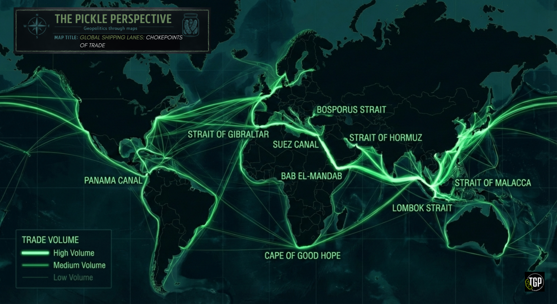
Global Shipping Lanes: Chokepoints of Trade
Global Maritime Trade and Strategic Chokepoints
Around 80–90% of global trade by volume is transported by sea, making maritime routes the backbone of the global economy. These shipping lanes are not merely commercial pathways but highly strategic arteries whose control, disruption, or protection carries significant geopolitical consequences.
The map highlights the concentration of traffic through a small number of critical chokepoints, including the Strait of Malacca, the Suez Canal, Bab el-Mandeb, and the Panama Canal. Their geographic narrowness creates structural vulnerability: blockages, conflict, piracy, or state coercion in any of these locations can generate cascading economic effects across continents. Recent disruptions in the Red Sea and periodic congestion in Suez underscore how quickly local instability can translate into global supply shocks.
The strategic importance of sea lanes was articulated by Alfred Thayer Mahan in The Influence of Sea Power upon History, where he argued that control of maritime commerce underpins national power. In an era of renewed great-power competition, that logic remains intact. Naval presence, port infrastructure, and the security of maritime corridors now sit alongside supply chains and energy flows as central components of geopolitical strategy.
In a globalised system, maritime geography continues to shape both economic resilience and strategic vulnerability.
Data: UNCTAD maritime transport statistics; IMO shipping density data; author visualisation.
The Pickle Perspective — Geopolitics through maps and data.