
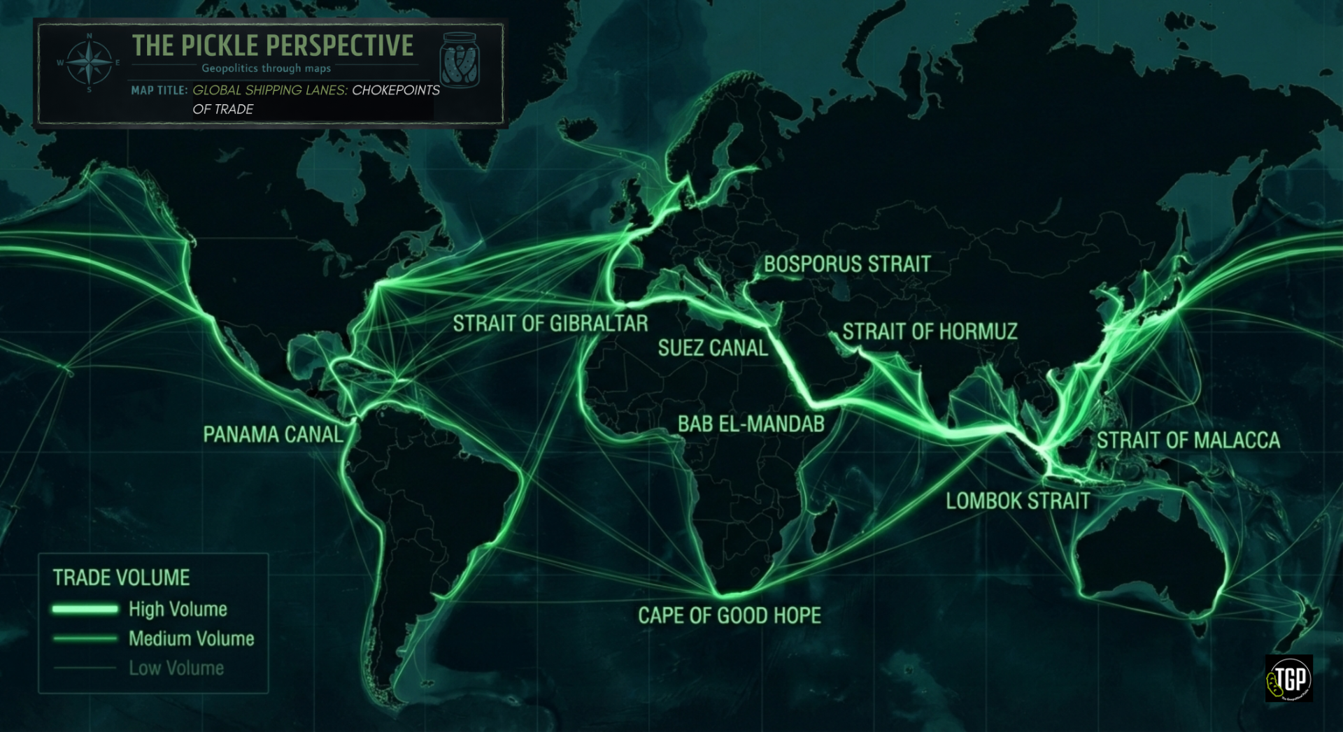
Global Shipping Lanes: Chokepoints of Trade
Around 80–90% of global trade by volume is transported by sea, making maritime routes the backbone of the global economy.


Explore fascinating maps that reveal the hidden dynamics of global politics, trade routes, territorial disputes, and more. Each map tells a story about how geography shapes our world.

Around 80–90% of global trade by volume is transported by sea, making maritime routes the backbone of the global economy.

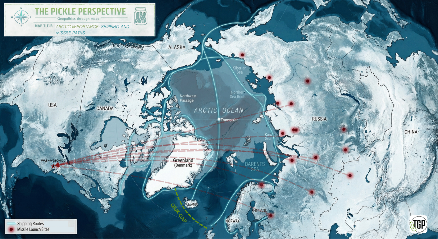
The Arctic is becoming increasingly geopolitically relevant as climate change reduces sea-ice extent and extends seasonal navigability.

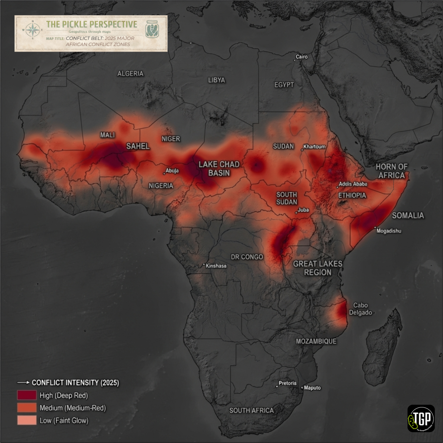
Patterns of political violence across Africa cluster in identifiable epicentres combining weak state control, transnational armed groups, and economically strategic territory.

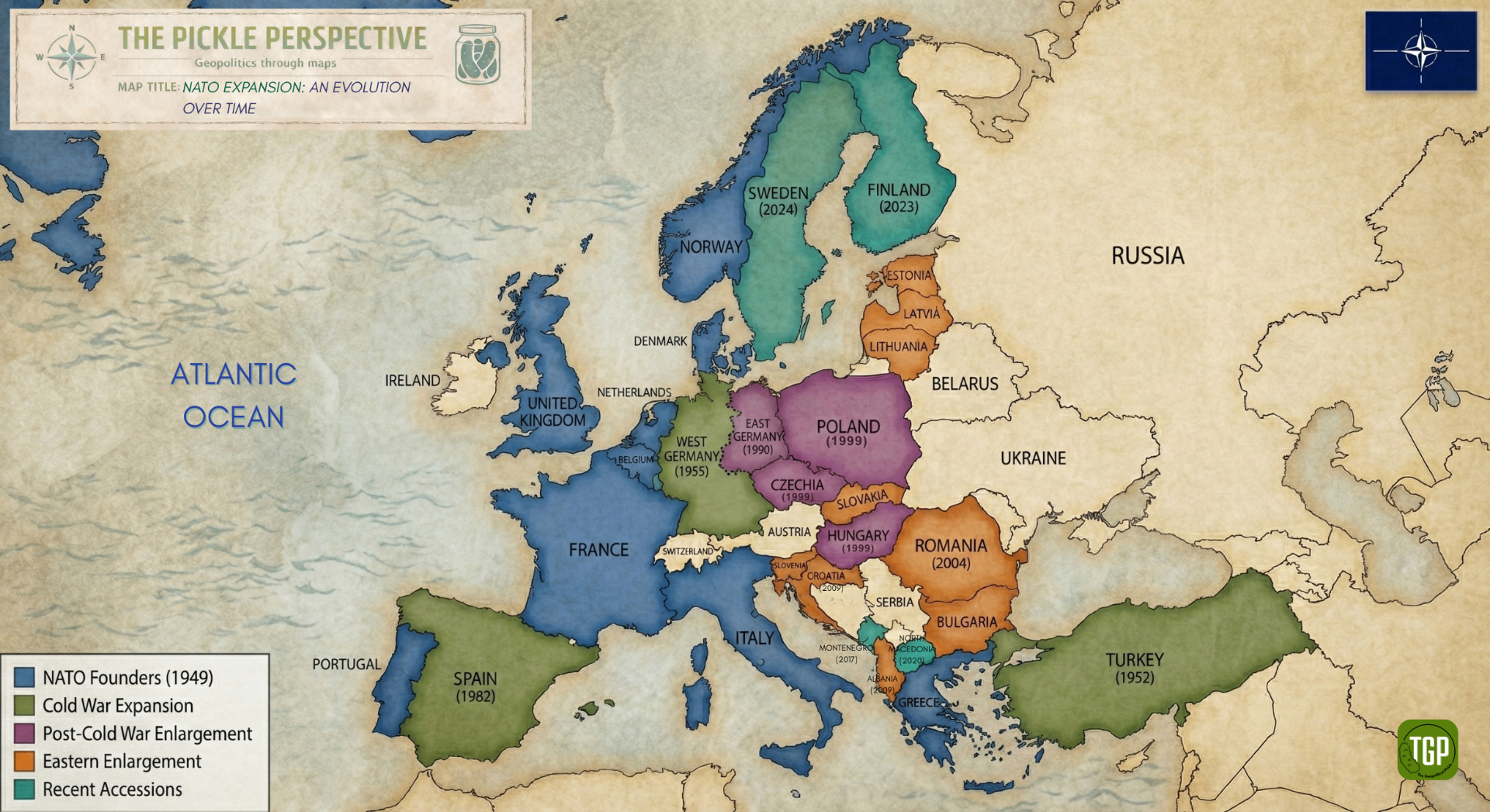
NATO's security perimeter has shifted eastward through successive waves of enlargement, reshaping the military geography of Europe.
We're always looking for fascinating maps that tell geopolitical stories. Submit your finds and they might be featured in our newsletter!
Submit a Map